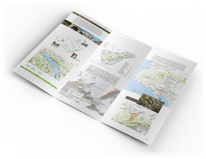
Use our online map editor to create custom maps to print.
Trusted by 10,000+ companies worldwide:
How to make maps that you can print

Welcome to Printmaps.net, your go-to solution for creating high-resolution printable maps. Whether you’re designing custom maps for travel guides, real estate brochures, or route maps, our online map editor makes it easy to create print maps in multiple formats such as SVG, PSD, or PNG.
Trusted by over 10,000 companies worldwide, our platform enables you to design and download printable maps for any purpose.
Our printable maps are designed for high-quality printing, with each map available in 300 DPI or vector format for clear, professional results.
You can download your map in a range of formats to suit your design needs, including layered PSD files for easy editing in Photoshop or vector SVG files for scalable projects.

Create custom maps online
At Printmaps.net, we offer an intuitive online map editor that allows you to create custom print maps for a variety of uses:
Frequently asked questions:
See the Knowledge Base for more.
What file formats are available for the printable maps?
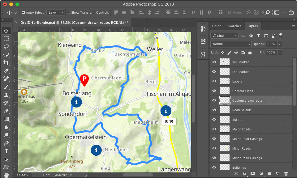
You will get your map in both a high resolution PNG format, a layered Photoshop file (PSD) or a layered vector file (SVG). The PSD map allows for customization in Photoshop, the SVG for customization in Adobe Illustrator or other vector graphics editors.
How do I get my map files?
You will get an email within minutes with download links to your high-res maps, plus another email with an invoice.
How can I design a map?
You can fine-tune the design of the map in our map editor (see tab “Design your map”), you can draw routes, upload geo data (GPX, KML, GeoJSON), plot POIs on your map (using a big range of marker designs and colors) or scale the features of your map (smaller or bigger fonts for example).
How can I modify a map after download?
Beyond the editor: To make it as easy as possible for you to design breathtaking maps you get your map as a layered Photoshop file (.psd) or layered vector file (.svg). Every map feature is a separate layer. This way you can modify elements of the map without destroying the layers below.
How can I pay for my printable map?
We accept major credit cards, PayPal, and bank transfers (for most European countries). Customers who require volume discounts can also pay via invoice.
What happens after I pay?
You will get an email with a proper invoice in PDF format (including VAT) plus another mail with a download link containing your map(s) as PNGs and PSDs.
What if I am not satisfied?
We have a generous 30-day return policy. Satisfaction guaranteed.
What rights do I obtain with the map?
When you purchase a map, you gain the rights to modify and reproduce it up to the print circulation that corresponds to the price category you selected. You can also use a downscaled version of the map on your website.
You must attribute the map correctly like you would do for a photograph. See complete Terms of Use for details.
Prices for our printable maps
- For unlimited print circulation ?
- All features
- Full usage rights ?
- For print circulation of up to 35 000 copies ?
- All features
- Full usage rights ?
- For print circulation of up to 1 000 copies ?
- All features
- Full usage rights ?
You will automatically receive an invoice your accountant will be happy with. Get in touch with us for subscription options.
Get Started with Printmaps Today
Create your custom printable map now and take advantage of our easy-to-use online editor. Whether you need print maps for personal projects or professional print jobs, Printmaps.net has everything you need to create beautiful, high-quality maps. Start now with our powerful map maker at the top of this page!
Use our online map maker to create maps to print.
Trusted by these fine companies:
Recent Comments