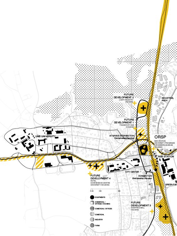
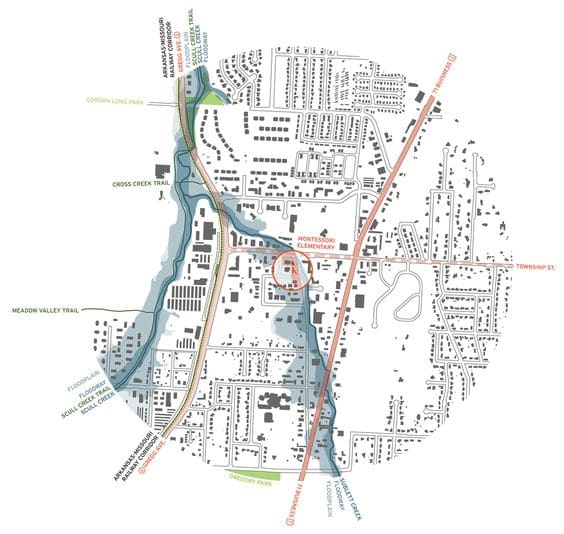
There are several ways architecture and design professionals use a map for site analysis. Nowadays, you don’t want to present heavy text and number data to your clients and co-workers. Using inspirational-looking maps to visualize your site data can both help you inform your clients and co-workers better and drive the creative process during your site analysis.
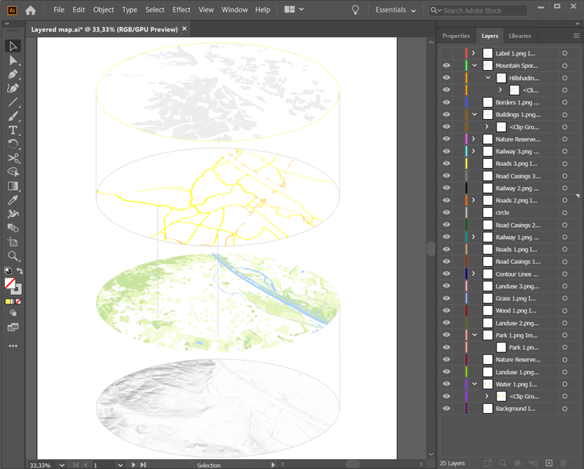
The Printmaps editor imports data from OpenStreetMap and makes it easy accessible for you to edit within the editor with shapes, layers that you can filter, routes and points of interests. The result you download in either a high resolution PNG or a layered PSD or SVG file.
Have a look at the features of our website’s online editor and how to use them.
Use a layered map from our site analysis maker
Architecture and design professionals can pick a variety of ways to present their architecture site analysis, all of them including the use of maps. With either Adobe Illustrator or Photoshop probably being a long trusted friend during the data visualisation process, the question remains; where to get a high resolution map image, preferably already layered and labeled?
This is where Printmaps steps in
Within minutes you have downloaded a layered map image. With the online map editor you can select any site, pick filters and add shapes and content. Receive a layered PSD or SVG file and the magic in your editing program of choice can start.
The final result is high resolution and suitable for quality print, up to a maximum size of 1330mm x 1330mm.
That’s why a Printmap forms a perfect foundation map for site analysis.
For flat fee options please contact us.
Try Printmaps
Our map-editor lets you create printable maps worldwide in no time.
Start by clearly defining what the map area is you want to display. Choose your zoom level and the map area size based on your use-case, i.e. choosing a zoomed in view of the neighborhood vs. a zoomed out view of the greater surrounding area. Select which are the elements most appropriate to highlight for your use-case. This can range from displaying environmental factors, such as the trajectory of the sun or the weather face in relation to the property in question, to highlighting the property boundaries, existing buildings and natural features in the area.
Recent Comments