Are you looking to create a travel map for your photobook or travel blog? Gathering all the beautiful memories of your travels is a great way to hold on to these valuable experiences. Look back at your journey and adventures with a personally designed map that shows your exact travel route.
With the Printmaps online map editor you can easily draw a route on existing roads on your selected map area. Add points of interest, country and city shapes in different colours and receive a high resolution map, ready for any further editing and print. Learn about the features of the Printmaps editor and how use them.
We’re happy to share some ideas and tips to help you make your travel map as awesome as the trip itself!
Design your photobook travel map with coloured shapes
Add the shape of a country and choose “invert”. This way, with a single click, the surroundings of the country, both water and land, turn to the colour of your choice. For example, you can make them the colour of water (RGB, 173, 255, 209), or white, to separate the country of its neighbouring countries and create a floating effect. With the option to adjust the shape transparency, you can colour countries without losing the display of roads, rivers and mountains. Would you like to create a world map and show all the countries you visited? Give all of them a different colour.
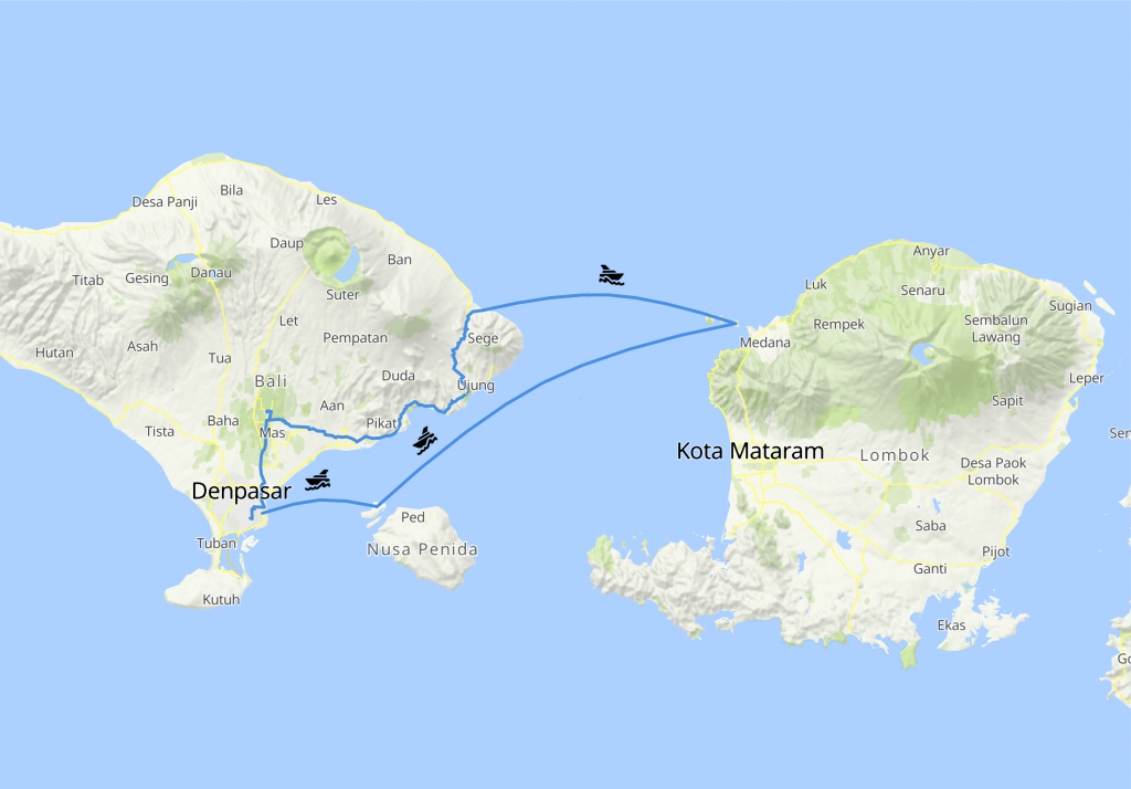
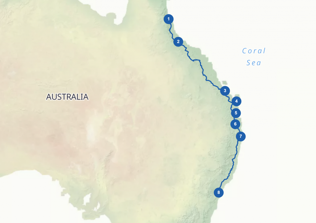
Use different POI markers to pin different trips
You can mark your points of interest with dots, squares or any of the standard shapes provided in the editor. Add a label to the markers or number them to display the chronological order of your trip. Or, display the label without a surrounding marker, like an airplane or a ferry. Mark your favorite restaurants, hikes or beaches. If you can’t find what you’re looking for in the editor, easily upload your own custom markers!
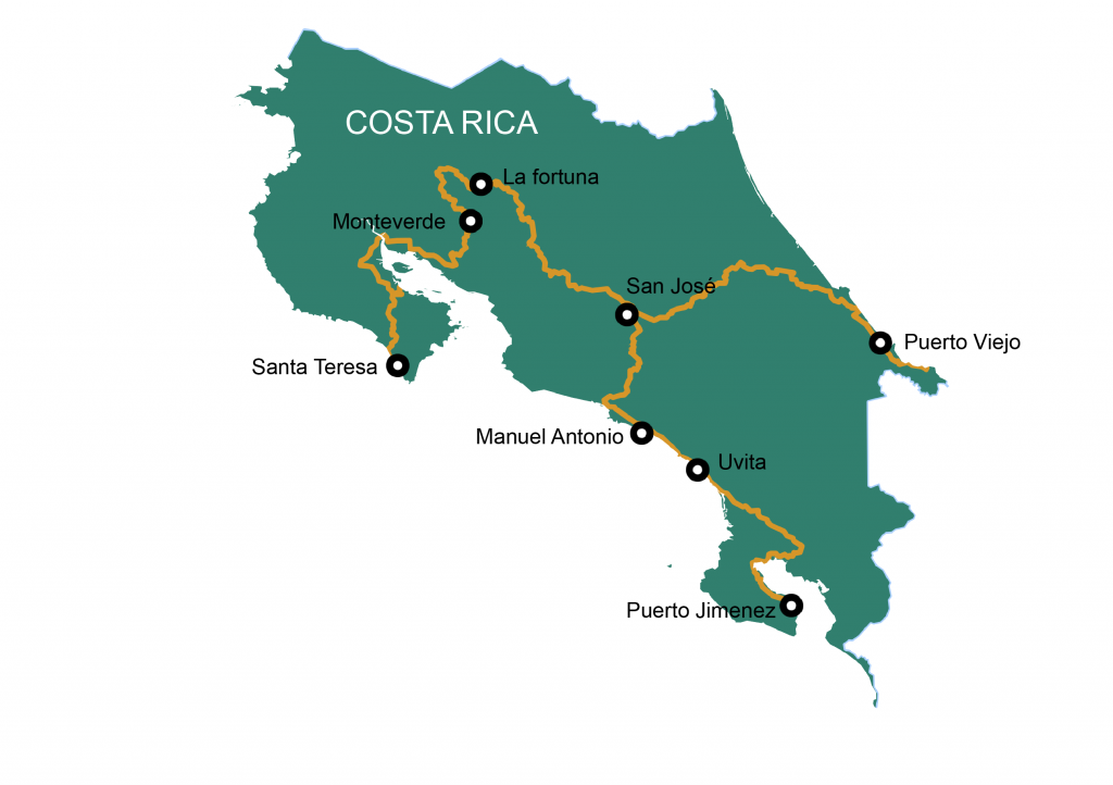
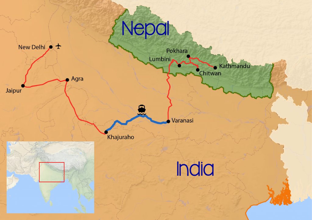
Easily create a route map with the route editor that draws on the exact roads you travelled!
Combine Printmaps to show your travel in world view
If you want to show a close-up of your travel route and a world view with your destination highlighted, then combine two Printmaps! After creating your maps you receive a file that is ready for editing in Photoshop or Illustrator, or any other editing program you might use, to add the finishing touches to the maps and to put them together into your awesome, personalised travel map.
Try Printmaps
Our map-editor lets you create printable maps worldwide in no time.